
New georeferenced resource for road projects
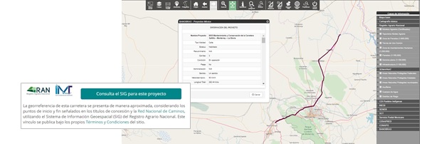
Starting December 2018, Mexico Projects Hub incorporates the joint efforts of the Mexican Transportation Institute (IMT), the National Road Network, and the Geospatial Information System (GIS) of the National Agrarian Registry, for georeferenced maps of highway projects, considering the start and end points indicated in their concession titles.
This tool is available for projects in operation published in Mexico Projects Hub that have the set of coordinates that describe their layout.